
📊 Full opportunity report: The City That Watches Itself: The Living Digital Twin, And The God’s-Eye View We’re Building on ThorstenMeyerAI.com — validation score, market gap, and execution plan.

Get the latest gadgets delivered free with Prime
- Fast, free delivery on millions of items
- Prime Video, Amazon Music and more included
- Member-only deals all year
TL;DR
Cities are now building dynamic, real-time digital twins that integrate live sensor data and advanced AI, enabling unprecedented urban monitoring and planning. This development raises both efficiency and surveillance concerns.
Urban digital twins are evolving into real-time, highly detailed virtual replicas of cities, integrating live data from sensors, satellites, and AI systems. These models serve both as planning tools and powerful surveillance instruments, raising questions about privacy and control, according to experts.
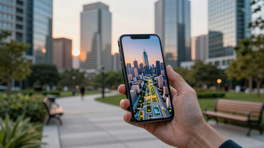
Recent advancements in sensor technology, such as Wide-Area Motion Imagery (WAMI), all-weather radar, and satellite imaging, have enabled cities to create continuously updated, detailed virtual models of their infrastructure and activity. Notably, Singapore’s Virtual Singapore exemplifies this, modeling every building, road, and utility in three dimensions with live overlays, and extending underground to include subsurface infrastructure.
These digital twins are now being enhanced with frontier AI models capable of understanding complex, heterogeneous data streams in natural language. This allows city officials and analysts to query the twin in plain language, obtaining detailed insights or running simulations, effectively turning the twin into an oracle of urban life. However, this technological convergence also introduces significant surveillance capabilities, making these models both tools for efficiency and instruments of oversight, sparking debate over privacy and sovereignty.
The city that watches itself: the living digital twin, and the god’s-eye view we’re building
Soon most cities will exist twice — once in concrete, once as a live data model you can rewind, simulate, and question in plain language. Persistent sensing + frontier AI turn the planner’s digital twin into an oracle. The most useful thing we’ve built — and the most powerful surveillance instrument. Both at once.
- Plan better — cities & rural: traffic, zoning, energy, land use
- Emergency response — route crews, one live picture, ~50% faster
- Disaster resilience — simulate, track live, assess damage in hours
- Mass surveillance — track everyone, retroactively, forever
- Pattern-of-life — AI links movements, infers associations
- Social control — no warrant, no suspicion (cf. Baltimore, 2021 ruling)
We’re building a city that watches itself, remembers everything, and can be asked anything. The technology won’t choose between saving lives and ending privacy — we will, through the rules we write now, while the twin is still under construction and the defaults haven’t yet hardened into permanence. WAMI and the living twin open our lives to a view from the heavens that, from the dawn of civilization until a heartbeat ago, was reserved for gods and stars. The question is no longer whether we can see everything — it’s who gets to look, and who watches the watchers.
Implications of Real-Time Digital Cities
This development marks a shift in urban management from reactive to anticipatory planning, potentially reducing costs and improving infrastructure resilience. However, it also amplifies concerns over surveillance, data sovereignty, and the potential misuse of detailed city data by governments or foreign entities. The ability to monitor every vehicle, pedestrian, and infrastructure element in real time could fundamentally change notions of privacy and civil liberties in urban areas.
As an affiliate, we earn on qualifying purchases.
Advances Enabling the Digital Twin Era
The concept of digital twins in urban planning has been around for several years, with early implementations like Singapore’s Virtual Singapore and city projects in Helsinki and Las Vegas demonstrating the potential for real-time, data-driven management. Recent technological breakthroughs—particularly in wide-area sensing, synthetic-aperture radar, and frontier AI—have now made these models more comprehensive and interactive. These advances allow cities to simulate scenarios, optimize resource use, and respond proactively to emerging challenges, but also raise the stakes for data security and sovereignty.
“The convergence of sensors, AI, and data integration is transforming cities into living, breathing entities that can be monitored, understood, and managed in real time.”
— Thorsten Meyer, AI researcher
real-time city monitoring IoT devices
As an affiliate, we earn on qualifying purchases.
As an affiliate, we earn on qualifying purchases.
Unresolved Privacy and Sovereignty Concerns
It is not yet clear how governments will regulate or control these increasingly powerful digital twins, especially regarding data sovereignty and privacy. The potential for foreign or private entities to host or influence city models raises questions about security and autonomy. Additionally, the legal frameworks needed to govern such surveillance tools are still under development, and public acceptance remains uncertain.
As an affiliate, we earn on qualifying purchases.
Future Developments in Urban Digital Twins
Cities are expected to expand their digital twin capabilities, integrating more sensors and AI features, and deploying them in larger urban and rural areas. Regulatory frameworks and privacy protections are likely to be developed in response to growing concerns. Meanwhile, debates over data ownership, security, and ethical use will intensify as these models become more embedded in urban governance and daily life.
As an affiliate, we earn on qualifying purchases.
Key Questions
How do digital twins improve city planning?
They allow planners to simulate and analyze infrastructure changes, traffic flows, and environmental impacts in real time, reducing costs and improving decision accuracy.
What are the privacy risks associated with digital twins?
They can enable detailed surveillance of individuals and activities, raising concerns over civil liberties and data misuse by governments or private actors.
Are digital twins used in rural areas?
Yes, they are increasingly being applied to monitor farmland, forests, and infrastructure corridors, supporting precision agriculture and environmental management.
Who controls the data in these digital twins?
Control varies by city; some rely on local government, while others may outsource to private or foreign firms, raising sovereignty and security issues.
What legal protections exist for digital twin data?
Legal frameworks are still evolving, with some regions developing regulations, but comprehensive international standards are lacking.
Source: ThorstenMeyerAI.com
Halloween Picks
halloween
As an affiliate, we earn on qualifying purchases.